>
Tony Drake MBE Memorial Event - Wednesday 22nd May 2013
GETTING THERE
============
On Wednesday 22 May Ramblers from far and wide will be meeting up at Hambutts Field, Edge Road, Painswick (Grid Reference SO 863097) at 1:00 pm for a picnic and to celebrate the extraordinary life of Ramblers' Volunteer Tony Drake MBE, who died last year.
If you are not walking on the day and wish to come to the picnic and the ceremony, the information and maps below may be useful.
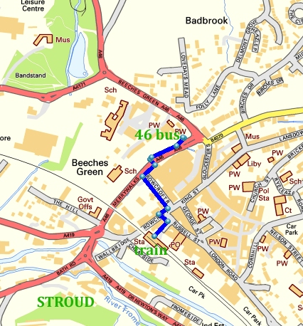
TRAIN STATION - The Nearest Train Station to Painswick is Stroud on the line from Paddington.
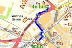
WALKING ROUTE TO THE BUS STATION - From the Train Station it is a walk of 400 yards to the bus station in Merrywalks. After crossing the footbridge to leave the station, the route is along Station Road, at the end cross over and turn L to reach Rowcroft, cross over and turn R in front of Lloyds Bank and after a few yards turn L down the narrow Rowcroft Retreat (where taxis wait) to reach Merrywalks at the bottom. Turn R and soon cross on pedestrian controlled lights to the bus stop for the No 46 service to Cheltenham (via Painswick).
===
BUS SERVICE 46 STROUD - CHELTENHAM - The bus runs every hour leaving Stroud at 5 mins to the hour and is due at Painswick at 4 mins past the hour. It returns to Stroud every hour at 16 mins past the hour from outside the church and is due back in Merrywalks in Stroud at 25 mins past the hour. Click HERE for timetable.
===
By Car to Painswick
Painswick is on the A46 road between Stroud and Cheltenham about 3 miles north of Stroud. Car parking in the narrow streets of Painswick is often problematical. It is suggested that you should try and park in the Stamages Lane Car Park at the south end of the village. For "satnav" enthusiasts the post code GL6 6UZ will find the car park. NB There is NO parking at Hambutts Field. Also Edge Road is very narrow with no turning space, so please do NOT drive along it.
===
By Taxi to Painswick
There is a taxi rank outside Stroud Train Station and it is about 3 miles to Painswick.
===
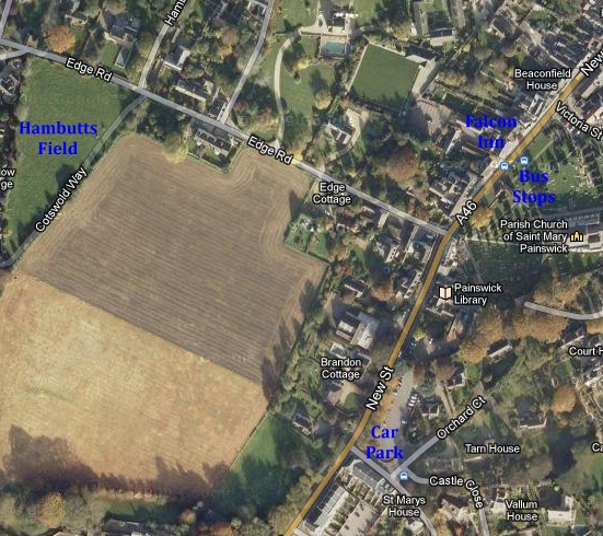
ARRIVING BY CAR
A Park in Stamages Lane CP (public toilets higher up). To repeat, there is NO parking at Hambutts Field. Also Edge Road is very narrow with no turning space, so please do NOT drive along it.
B Walk uphill 100 yards (New Street A46) to the junction by the parish church Lych Gate.
C Opposite is Edge Road and 200 yards of level walking brings you to Hambutt's Field.
ARRIVING BY BUS
D The bus stops are almost outside the Falcon Inn, a little higher up the main road than the Lych Gate.
E Walk down to the junction by the Lych Gate and turn left along Edge Road. Now See C above.
PUBLIC TOILETS
F From the Lych Gate the public toilets are down the main road in the Car Park on the left.
G Now follow B and C above.
ALTERNATIVE PARKING FOR GOOD WALKERS
Permission has been obtained for parking near to the tennis courts at Painswick Rugby Football Club and Sports Club -see map below.
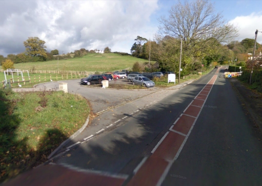
Coming from the Stroud direction, the entrance is on the left off Stroud Road before the climb up into Painswick on the A46. Do not park near the main road but continue along the drive to the tennis court area where there about 25 car parking spaces. A public footpath runs along this drive. After parking your car, go through the kissing gate and turn right on to the Cotswold Way to do a fairly steep walk up the fields to bring you directly into Hambutts Field.
KEY TO MAP BELOW - Yellow dots = Parking places, Purple dots = Walking routes, Purple triangle = Hambutts Field
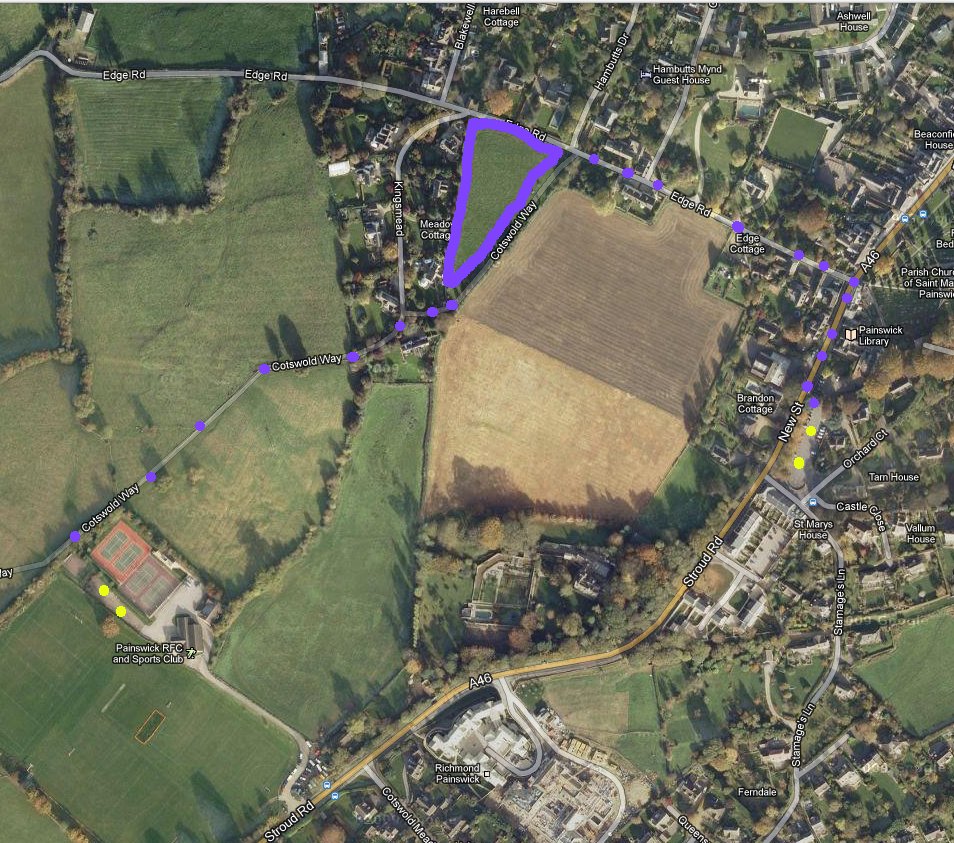
Entrance coming from Stroud Direction on A46
NB A new house has been built near this entrance since the photo was taken